Deer and Wildlife Surveys
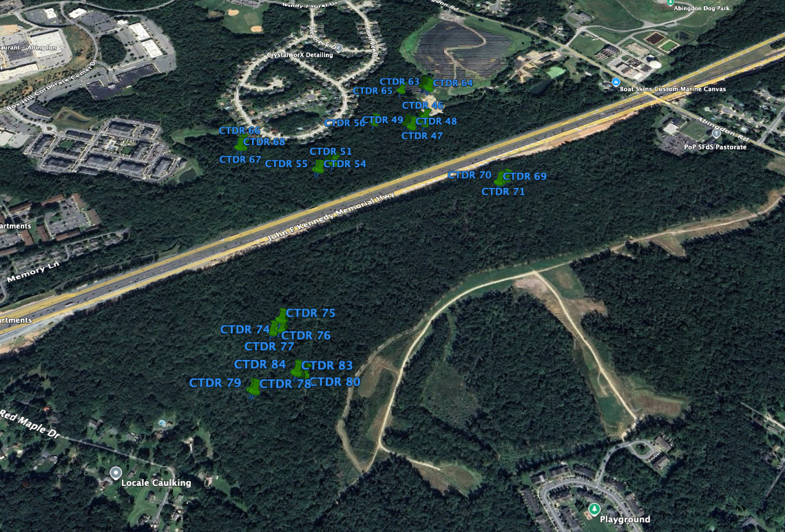
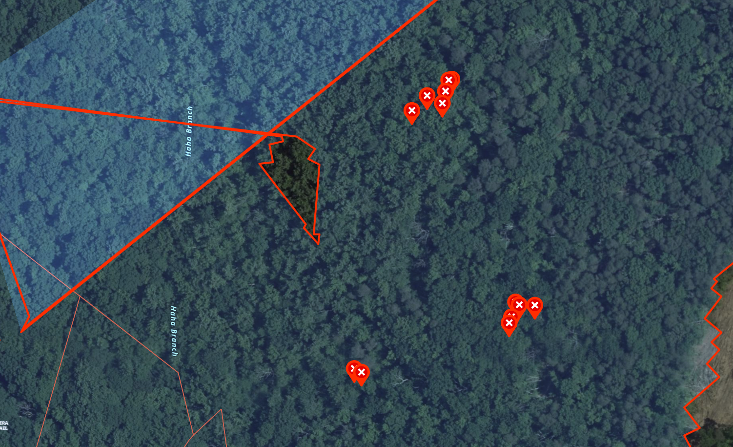
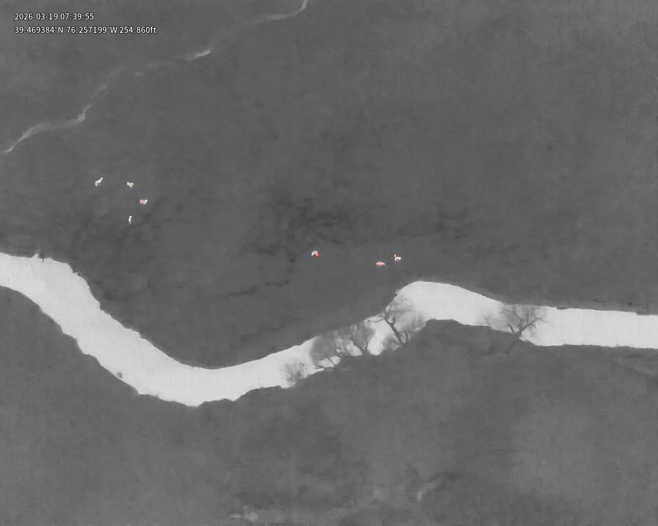
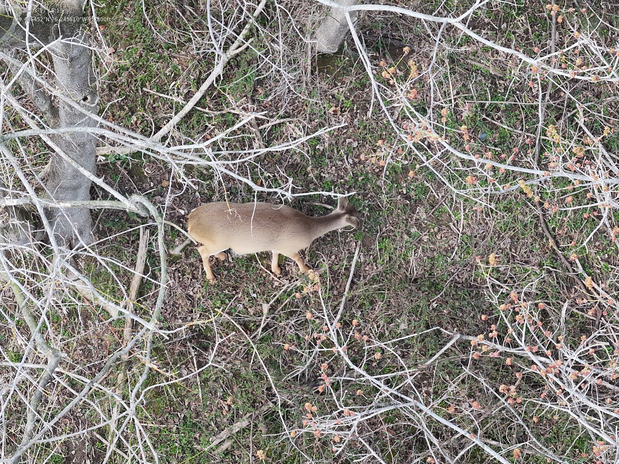
Chesapeake Thermal Drone Recovery can survey your property to accurately count deer and wildlife. Using enterprise grade thermal drones - wildlife can’t hide! If you think trail and cell cameras are valuable tools for wildlife management, just wait till you see the power thermal drones provide! How many deer have you missed on your property that just didn’t walk in front of your camera?
Whether you’re looking for total number of deer on your property, an accurate buck-to-doe ratio, bedding areas, predators, or maybe trying to catch trespassers on your property - we can help.
Here is what you can expect:
Watch the survey live on our second monitor - see what we see!
For a small additional charge - receive a video of the entire survey.
Accurate census of the wildlife on your property.
Buck-to-doe ratios (buck to doe ratios are best done in December/January)
Photos of each buck we see (photos of bucks for a small extra charge)
Survey results sent to you on a .kml file to be viewed in Google Earth or the OnX Hunt App
Contact us today to schedule your deer/wildlife survey!
Prices start at $1.50/acre and $0.73/Mile